Berth A (deeper (100 m), further offshore (16 km)); Berth B (shallower (50 m), nearer shore (6 km) | Atlantic Marine Energy Test Site (AMETS)
Atlantic Marine Energy Test Site (AMETS)
| Lead Organisation | Sustainable Energy Authority of Ireland (SEAI) |
| Country | Ireland |
| Type | Wave |
| Website | http://www.oceanenergyireland.ie/TestFacility/AMETS |
-
Type of Testing Wave Year Established 2011 Temperate/Tropical Temperate Commercial/Array/Full scale/Scale Full scale, Research (non-commercial) Development Status All permissions in place; infrastructure build to commence Overview
The Atlantic Marine Energy Test Site (AMETS) is being developed by Sustainable Energy Authority of Ireland (SEAI) to facilitate testing of full-scale wave energy converters in an open ocean environment.
AMETS will be located off Annagh Head, west of Belmullet in County Mayo and will be connected to the national grid.
The test site is an integral component of Ireland’s Ocean Energy Strategy and is being developed in accordance with the national Offshore Renewable Energy Development Plan (OREDP).
The site will be focused on wave energy and will provide two separate test locations at various depths of water to allow for a range of devices to be tested.
It is envisaged that the test site will provide a grid connected national test facility, to which full scale wave energy converters could be coupled during their final stages of pre-commercial development. -
Number of Berths 2 Water Depth A = 100 m, B = 50 m Min Water Depth (m) 50 Max Water Depth (m) 100 Avg Water Depth (m) Annual mean significant wave height Maximum recorded wave height Mean (averaged current speed) Maximum current speed Maximum tidal range Mean wind speed Max wind speed Seabed type A mix of sand, gravel/coarser sediment and bedrock at seabed. Total test area (km2) 8.4 Distance to land 6 - 16 km Grid connected Y Grid connection capacity 10 MW Rated export capacity and connection Proximity to nearest harbour (km) The test sites will be accessible via Frenchport Pier; 14 km from Berth A & 6 km from Berth B. -
Demonstration Projects
No demonstration project has been deployed yet.R&D Projects
No R&D project has been deployed yet.Infrastructure
The test site is not yet in operation for developers but SEAI can offer interested developers a suite of detailed information such as live met-ocean data measurements, numerical wave modelling reports including wave propagation and wave energy assessments, offshore site investigations including vibrocores and multi-beam surveys.Equipment available to support site deployments
2019/2020 – environmental surveying is ongoing.
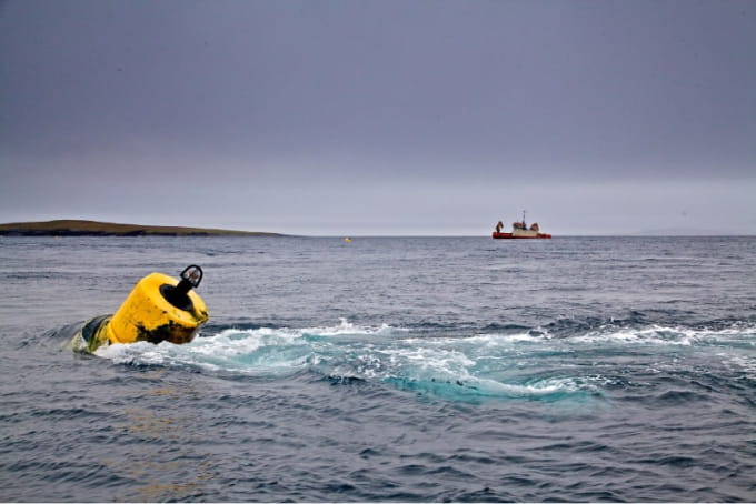
Wave Rider Buoy and ADCP are permanently deployed at Berth A and Berth B. See Data Buoy Dashboards for (nearly) live information.Key supply chain companies in the region
- Ocean Energy Supply Chain Database - http://www.oceanenergyireland.ie/SupplyChain/Database