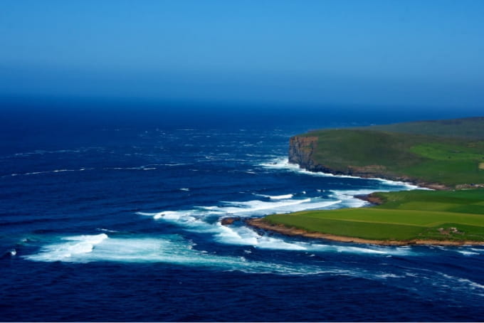
Billia Croo wave test site | European Marine Energy Centre (EMEC)
European Marine Energy Centre (EMEC)

| Lead Organisation | European Marine Energy Centre (EMEC) |
| Country | UK |
| Type | Wave, Subsea components |
| Website | https://www.emec.org.uk |
-
Type of Testing Wave, Subsea components Year Established 2003 Temperate/Tropical Temperate Commercial/Array/Full scale/Scale Full-scale Development Status Operational Overview
Subjected to the powerful forces of the North Atlantic Ocean, it is an area with one of the highest wave energy potentials in Europe.
The site consists of five cabled test berths in up to 70m water depth, located approximately 2km offshore and 0.5km apart. In addition to this, a near shore berth is situated closer to the substation for shallow water projects.
The five 11kv subsea cables feed into the EMEC substation which houses the main switchgear, backup generator and communications room, and has been carefully designed to minimise visual impact. These cables feed the electricity generated by the wave energy converters testing on site directly into the national grid.
Three waverider buoys are located on site measuring the wave height, period and direction, and a purpose-built weather station provides real-time met data for the site. This data is fed into a sophisticated SCADA (Supervisory, Control and Data Acquisition) system, with live data feeds on the wave and met conditions available to view on our website.
The test site berths are monitored by CCTV situated at our observations point at the Black Craig. This is controlled remotely from our data centre and office facilities. -
Number of Berths 6 Water Depth cabled test berths in 50-70m, near shore berths 20m Min Water Depth (m) 20 Max Water Depth (m) 70 Avg Water Depth (m) Annual mean significant wave height 2-3m Maximum recorded wave height 18m Mean (averaged current speed) Maximum current speed 0.5 m/s Maximum tidal range 2.9 m Mean wind speed Max wind speed Seabed type The seabed beneath the wave test site has sandy deposits towards the northern area with glacial till overlying shallow bedrock to the southern end. Surveys at deeper sites showed some hard substrata with the area predominantly supporting sedimentary biotopes and biotopes characteristic of sand scoured rock Total test area (km2) 8.4 Distance to land 2 km Grid connected Y Grid connection capacity 7 MW Rated export capacity and connection 2 MVA Proximity to nearest harbour (km) 8km (Stromness Pier) -
Demonstration Projects
R&D Projects
Infrastructure
Five cabled test berths in 50-70m, near shore berths 20m
Metered at point of connection to the EMEC 11kV network, using voltage transformers to IEC60044-2, current transformers to IEC60044-1, power transducers to IEC60688
Berthing & working areas, office facilities
SCADA - http://www.emec.org.uk/facilities/scada/Equipment available to support site deployments
3 Datawell Directional Waverider® buoys (live data)
Multiple ADCPs, different frequencies.
Meteorological station (live data)
Baseline surveys:- Hydrographic survey
- Seabed geology survey
- Wildlife observations
- Multiple wave rider surveys
- Hydrodynamic modelling study
- Meteorological data Acoustic survey
Services of test programmes offered on site
Key supply chain companies in the region
Supply chain at: www.orkneymarinerenewables.com